The Southern Colorado Loop
Sun Jun 23 2024
Quick Stats
I recently completed a five day, 550km (350m), solo bikepacking loop in and around the San Luis valley in southern Colorado. The ride turned out to be absolutely amazing so I wanted to share the route.
Note: I did this on a gravel bike (Specialized Diverge) but a mountain bike would've been much better.
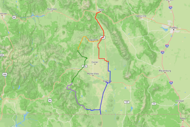
Here is an overview of the route:
And here are GPX files of each day:
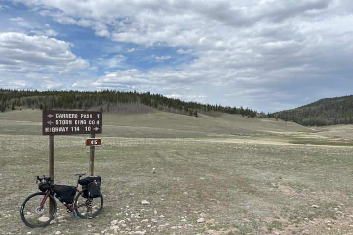
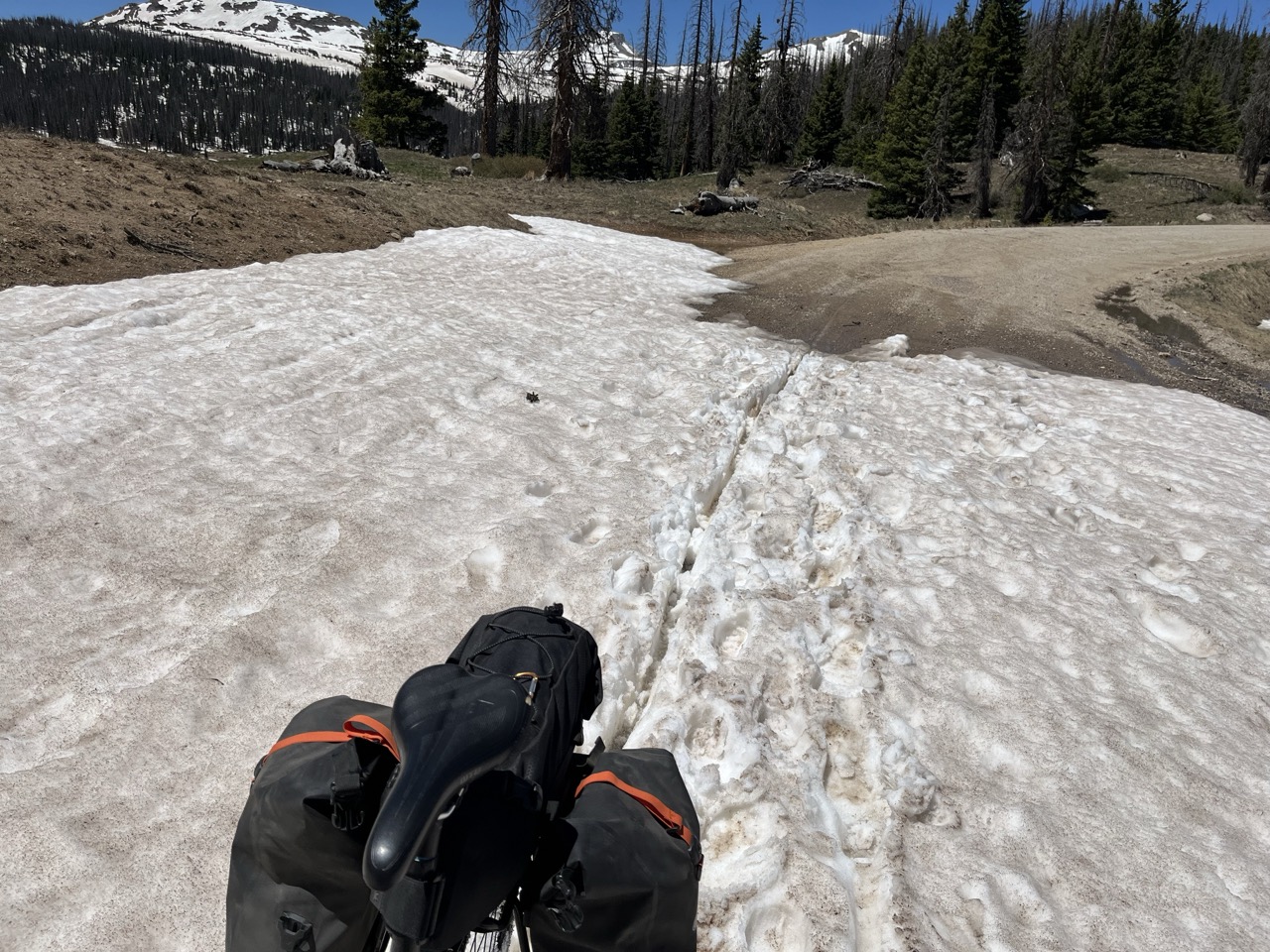
Day 1 : Salida to Storm King Campground
My fresh legs wore off fast with a long grind of 120km (75 miles) and two passes. The extra mileage and climbing was made easier by much of it following Highway 285 between Salida and Saguache. This stretch of road has a 6+ foot shoulder with so it is pretty safe in spite of the high volume of traffic we have now in central CO. There is an approximately 8 mile stretch between the top of Poncha Pass and Villa Grove that has a smaller 2-4 foot shoulder but the main traffic lanes are wide and there is plenty of room. The wind can give you a bad time along this stretch so check the forecasts.
From Saguache I headed west on county road Z, and then used a stretch of CO Hwy 114 to reach county road 41G. Hwy 114 has a minimal road shoulder but has much lower traffic volume than highway 285. I only counted 7 vehicles while I was on 114.
Amazing scenery started right away as I headed south on county road 41G. The road alternates between small canyons and wide open meadows as it climbs towards Carnero Pass. I stopped and did some arrowhead hunting and general rock prospecting at several points along the road. 41G is a very well maintained road that is fine for a gravel bike. From the top of Carnero pass it was a simple cruise downhill to the Storm King campground.
Storm King campground only has 6 spots and they are all fist-come first-served. There is plenty of wild camping available nearby as well. I stayed on a Monday night in early June and there were only 2 other spots being used. There is no water at this campground. There is a creek nearby, but lots of cattle are grazing and pooping upstream. Fresh well water is available at Penitente Canyon early in the next day's ride.
Day 2 : Storm King Campground to Grayback Mountain
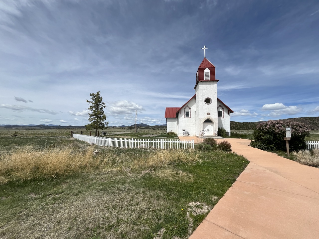
A long coast along 41G down Carnero Creek starts the second day. After exiting the mountains I noticed the top of an old church poking up over a ridgeline so I went to check it out and found the San Juan Catholic Spiritual Center. I'd recommend a stop here for the amazing views of the valley in a spiritual setting. From La Garita, roads 38A, 33, and highway 112 took me past lots of antelope and to Del Norte.
Penitente Canyon is right at the start of road 38A and has some really neat features. There is also a fresh water station right at the entrance of the area. I had to run the water for a minute or two before it ran clear, but otherwise it was fine and didn't give me any issues.
One of the main highlights of the entire trip was getting an Albequerque Turkey sandwich at Simple Foods in Del Norte. If you want one you'll have to get there before 2pm! There are a couple of grocery stores and gas stations to use to stock on supplies for the next two nights in the San Juan Mountains.
From Del Norte I had to get my climbing gears ready because county road 14 had some serious vert waiting for me. The climb up to the top of Indiana Pass is the biggest of the entire loop but I didn't notice how hard it was because of the stunning views. For my ride the road had been freshly graded and super smooth - no problem for a gravel bike. I didn't notice any very good water options on road 14, but I was fully stocked from Del Norte.
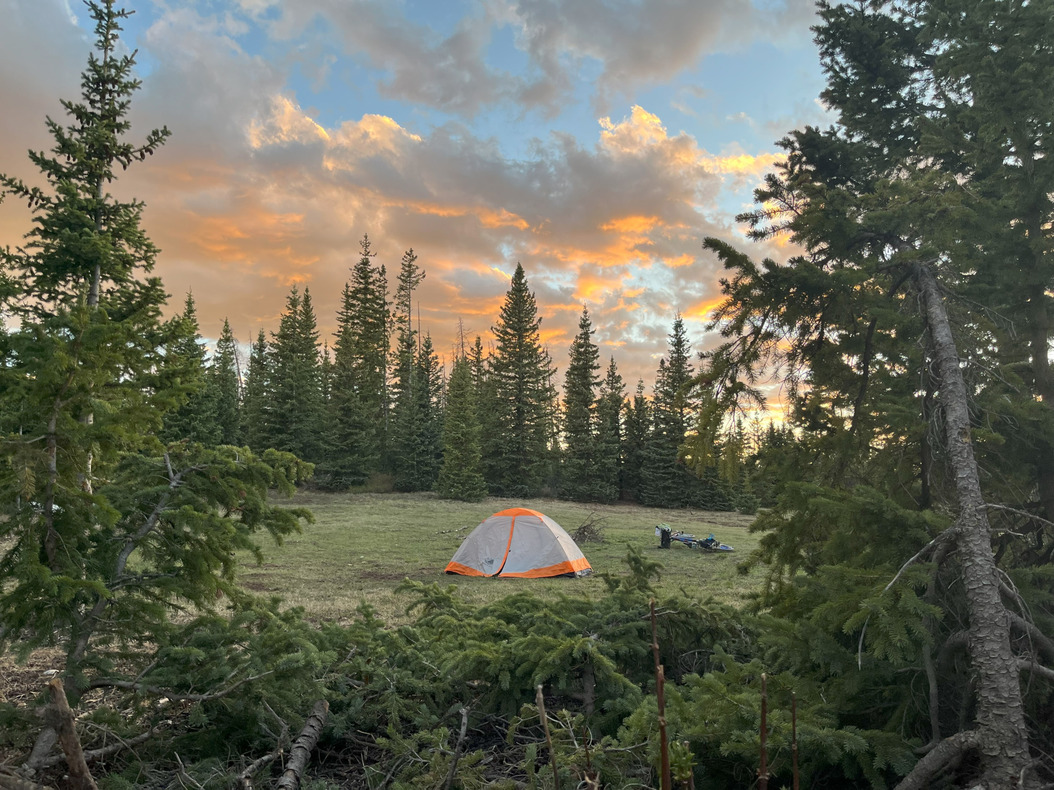
Once I got into national forest I noticed plenty of camping options along both roads 14 and 330. I had a 15 degree sleeping bag with me so I decided to camp at a higher altitude and wound up in this meadow. There was a hungry little chipmunk who lives in the meadow. Since I left my bike on its side overnight the chipmunk chewed up both my handlebar tape and my bike seat. It also scratched at my tent every 15 minutes from about 2am to 4am. At least I was able to take in the incredible views of the Milky Way during those awake times.
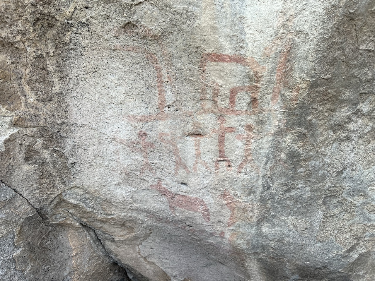
Petroglyphs at Penitente Canyon:
The San Juan Catholic Spiritual Center:
High Altitude Camping near Grayback Mountain:
Day 3 : Grayback Mountain to Aspen Grove Campground
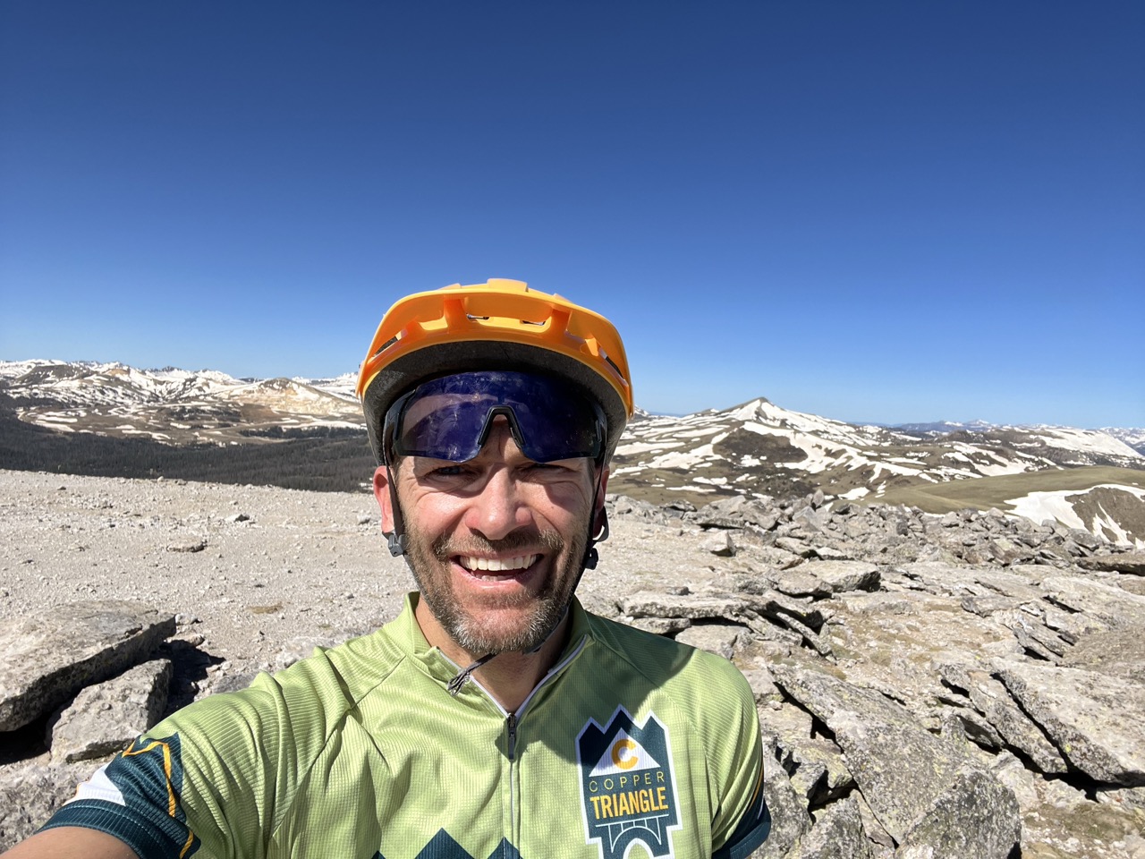
A climb to the top of Grayback Mountain was a fantastic side challenge to start off day 3. It took me less than an hour to get to the top of the mountain and back down to where I had stashed my bike. If you're on a mountain bike you can easily ride all the way to the top.
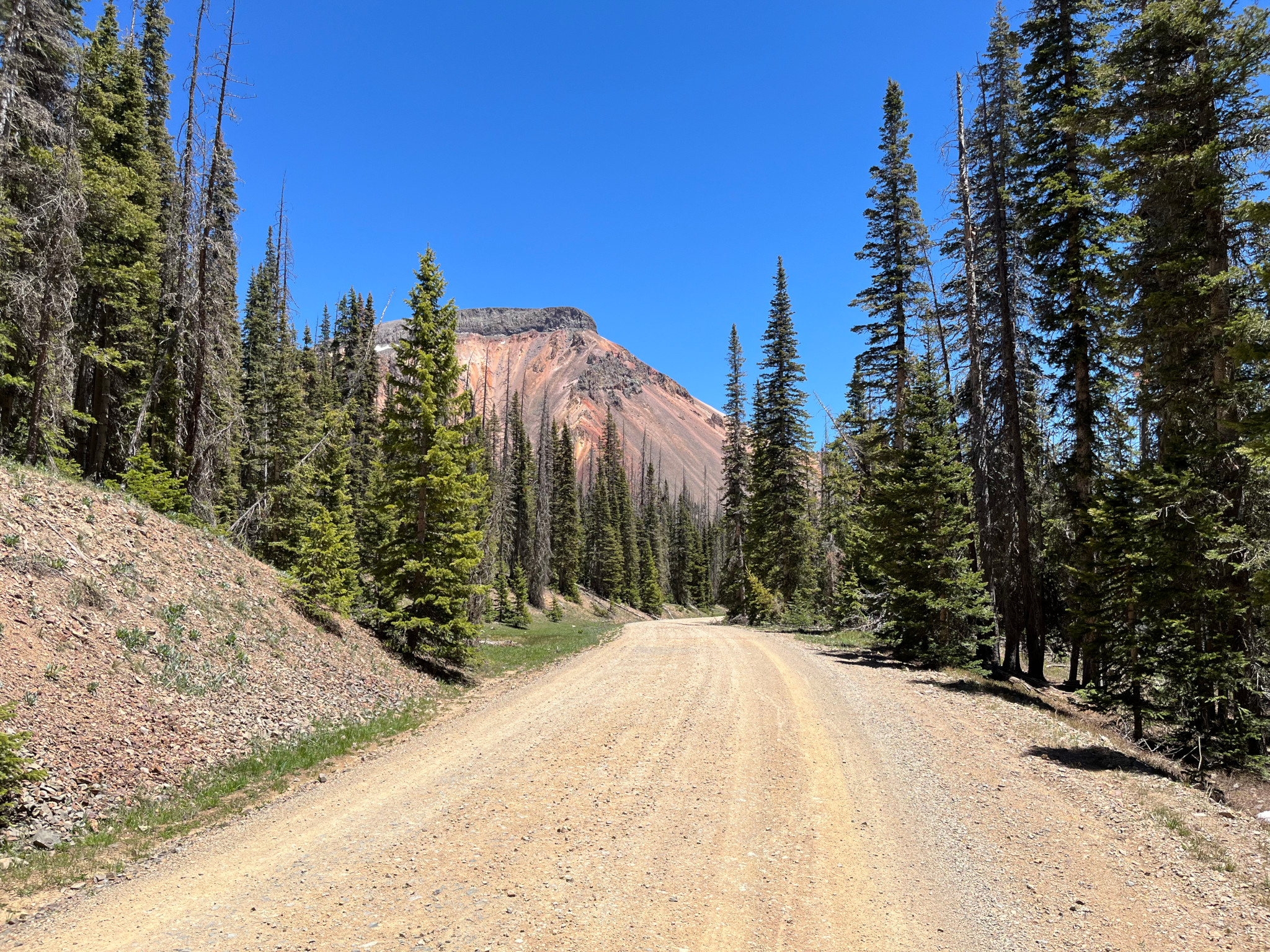
Continuing along road 330, after Grayback Mountain came Summitville Mine. This is an interesting site and explains why the roads are so good. They must've needed to haul enormous amounts of equipment up there to do the cleanup. I made sure not to pull any water from streams near or below the mine. From road 330 I turned onto road 380 which goes past Elwood Cabin. This stretch of road hadn't opened to cars yet and I did wind up pushing through some snow drifts.
The descent along 380 down to Stunner Campground made me start to wish I was on a mountain bike. I would normally ride this kind of road on my gravel bike, but with the extra bikepacking weight I felt it was starting to be too much. I took it slow and tried to ease my bike along but still wound up rattling my headset loose and had to do a field repair on it (I've never been too sure about the durability of the Specialized FutureShock).
I was actually glad to be able to ride uphill for a bit after heading south on road 250 at Stunner Campground. Then came another bruising downhill to Platoro. During my original route planning I had totally missed the fact that there was a small outpost of civilization at Platoro. If I had known about the Sky Line Lodge I would've bought less food in Del Norte and worried less about trying to refill water. The lodge has fantastic burgers and fries and they are super friendly to cyclists and glad to let you fill up on water. Not only was the food great but it was cheap. At a time when every other restaurant in Colorado is charging $25 for a burger, the Sky Line Lodge felt like going into a small little oasis of the past when things were ok.
I was very fortunate to be able to eat lunch at the lodge with a guy named Cam who is doing the south to north tour divide route. It was really fun comparing notes on gear and hearing how folks managed in the New Mexico potions of the route. Through the first 3 days of my ride I ran into quite a few folks hiking and biking the route.
From Platoro I followed the Conejos river all the way down to highway 17. This long stretch of river scenery was truly amazing and I stopped several times to take it all in. Highway 17 has a very minimal road shoulder but I made it all the way to the Aspen Grove Campground having seen only a handful of cars. The campground was only about half full and I wound up getting a spot right by the river. Some other campers told me that the campground is usually packed.
Mount Grayback:
Snow on road 380:
Road 380 heading towards Stunner Campground (the mountain looks way more red in person):
Day 4 : Aspen Grove Campground to Hooper
This is the route I intended to take on day 4 : Day 4 Intended Route
However, things didn't go according to plan. As I was leaving the campground I heard a huge pop from somewhere on my bike. Turns out it was a spoke on my rear wheel. There wasn't much else to do besides keep riding and see how the wheel would do. I jettisoned a bunch of water and moved all my heaviest stuff to my front pack and hoped for the best. I got to Antonito ok so I took a quick detour to the Colorado/New Mexico border. Then I started heading north on Highway 285.
Highway 285 from the NM border all the way up to Alamosa is a great road for cycling. There is a wide 6 foot shoulder the entire way and not too much traffic and lots of small towns, farms, and good views of the valley. I was really thankful for this road because I wasn't too far north of Antonito when I got a second huge pop from my back wheel - another spoke. Now my wheel was really wobbling.
If only I had known about Fiber Fix emergency spoke repair before this ride!
Anyways, other than bailing out on the ride my only option was to limp into Alamosa and see if I could find a shop to fix my wheel. That turned out to be really difficult because Alamosa only has two bike shops : Kristy Sports and Gary (Alamosa Cycles). I tried Kristi Sports first, but they said they were booked out for a whole month. So I went to pay Gary a visit. Gary was having a bad day and also didn't have any spokes my size. So, back to Kristi Sports for one last ditch attempt. Thankfully their tech, Raleigh, had made some room in the schedule. He not only fixed my wheel but spotted a cut in my tire and got me setup with a new one. If you're ever in the San Luis Valley and need gear please go check out Kristi Mountain Sports. They also always sponsor the Splashland Triathlon each fall which helps keep the sport alive in this part of the state.
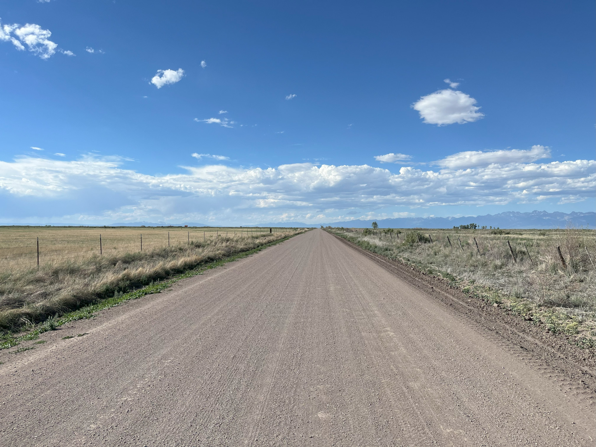
After the wheel repair I was able to get out on those long valley gravel roads that I had wanted to explore. From Alamosa I headed east on highway 160, and then took a turn north on county road 112. With the Sand Dunes nearby I was wondering how sandy the valley roads would be. Most of the ride north to Hooper was fine but there were quite a few places where I had to stop and push my bike - usually for only about 100 meters.
After a turn west on Lane 5N, and another turn north on county road 110 I finally made my way to Hooper and met my family who had come down to camp with me for the night. Hooper pool has showers and water. Note that all water at Hooper is hot because it comes from the spring. Showers are coin operated - 25 cents for 3 minutes.
A quick note about the San Luis Valley and dogs. While riding in the SLV you will get chased by dogs a lot. Probably every ten miles or so. Most are just ranch dogs having fun. Some are Pit Bulls that want to rip your legs off. I highly recommend pepper spray when riding anywhere in the valley. I even got chased by dogs while on highways 285 and 17.
County Road 112:
Day 5 : Hooper to Salida
I cheated on my last day. I sent everything except my frame bag home in the car with my family. We decided to hang out at Hooper Pool as well as have lunch there (the food at Hooper is fantastic). It was around 1 in the afternoon before I got on my bike. Since there was getting to be some crazy wind I didn't want to be riding home in the dark or breaking any more spokes.
I wanted to use farm roads in the middle of the valley to get from Hooper to Villa Grove. Highway 17 north of Alamosa has a narrow shoulder and lots of extremely high speed traffic. I had to modify the route I had originally planned because some roads that appear on maps didn't exist or were on private property. Here are the steps I took to get from Hooper to Villa Grove:
- North on road 63
- West on road D
- North on road 61
- West on road E
- North on road 59
- West on road G
- North on road 53
- West on road T
- North on road 52
- East on road X
- North on road 53
- East on road Y
- North on road 54
- East on road AA
- North on road 55
- North on Highway 285
Most of the roads through the valley were in great shape. There were sandy stretches that weren't rideable. There were also small spots of sand that could be really dangerous if you're not paying attention. On a day without wind this would be a really fantastic ride but for me there was just brutal amounts of wind. With all my bikepacking gear on I would have not made it home till the next day.
From Villa Grove going north along Highway 285 it was a tough slog against a headwind to the top of Poncha Pass. Then a fun coast home. Even though I was extremely tired I was sad that it was over which is a funny way to tell if you've had fun or not.
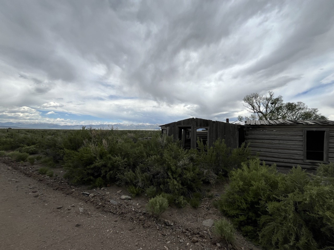
An abandoned homestead in the valley:
Final Thoughts
For a first time bikepacking adventure I feel that this was a fantastic ride. I learned a ton about bikepacking and what I need to do if I ever want to go for something longer. The Continental Divide route is calling.
If you'd like any additional info about the route please send me a message : aaronblondeau@gmail.com